Home / Books / GIS Report Automation Toolkit
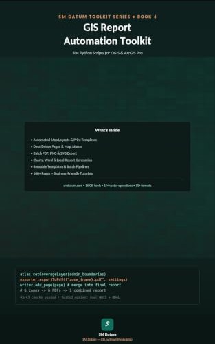
GIS Report Automation Toolkit book cover
Book 4 of 4 — SM Datum Toolkit Series

GIS Report Automation Toolkit: 50+ Python Scripts for Map Layouts, PDF Reports & Data-Driven Map Series

Turn finished analysis into finished deliverables — automated map layouts and print templates, data-driven pages and map atlases, batch PDF/PNG/SVG export, and chart, Word, and Excel report generation, in ArcPy and PyQGIS.

What's inside

Sample from the book

# PyQGIS — one PDF per zone, then merge into a single report
atlas.setCoverageLayer(admin_boundaries)
exporter.exportToPdf(f"zone_{name}.pdf", settings)
writer.add_page(page) # merge into final report
# 6 zones → 6 PDFs → 1 combined report
# 45/45 checks passed • tested against real QGIS + ArcGIS

Who this book is for

Frequently asked questions

What is a data-driven page / map atlas in GIS?

A data-driven page (ArcGIS Pro) or atlas (QGIS) automatically generates one map layout per feature in a coverage layer — for example one page per zone, parcel, or district — reusing the same layout template with each feature's extent and labels swapped in.

Can this export a batch of maps to PDF automatically?

Yes. The book includes scripts that iterate a coverage layer, export one PDF (or PNG/SVG) per feature, and optionally merge the individual PDFs into one combined report.

Does the book cover Word or Excel report generation, not just maps?

Yes. Alongside map/PDF automation, it includes scripts for generating charts and populating Word and Excel report templates from GIS attribute data.

Does this work with both ArcGIS Pro and QGIS?

Yes. The layout, atlas/data-driven-pages, and export scripts are provided in ArcPy for ArcGIS Pro and PyQGIS for QGIS.

What format is the book available in?

Kindle eBook ($9.99) on Amazon.
Try it free first

These free tools on this site cover related layout and export steps, right in your browser:

Part of the SM Datum Toolkit Series

Four books, 190+ scripts total, all in ArcPy and PyQGIS.